Hunter Access
In-Progress Projects
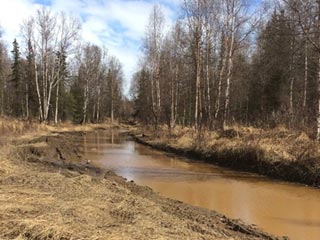
Matanuska Valley Moose Range Improvements — Mat-Su Valley
Coordinates: 61.67182, -149.20775
Game Management Unit: 14B
Land Manager: Department of Natural Resources (DNR); Division of Forestry
Description
The abundance of wildlife in the Matanuska Valley Moose Range (MVMR) make the area popular for the harvesting of moose, black and brown bear, Dall sheep, varying hare, grouse, ptarmigan, and a variety of furbearers. Fishing for salmon, Dolly Varden and rainbow trout is popular in the streams. Dolly Varden, grayling, and rainbow trout are also caught in Seventeen Mile, Wishbone, Chain, and Fish Lakes.

Purpose
In the Moose Creek Drainage, approximately 1,900 acres of the MVMR are accessible from the Palmer-Fishhook Road. Currently, the roads are closed to vehicular traffic due to the rapid deterioration of road conditions in the area due to rutting caused by ATVs and mud bogging. The currently installed gates to prevent access are no longer effective as people have driven trucks and ATVs around them, continuing to rut the roads and making it nearly impossible for others to access the MVMR, including hunters, wildland firefighters, and public users in general.